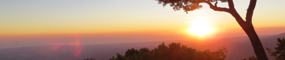
You’ve all read the story of the long, dusty, bouncy and stall-ridden trek from Quetzaltenango to Salamá, in Guatemala. If you haven’t, go ahead, I’ll wait here. Well, we’ve managed to do it one (or two, maybe three) better. We’d been noodling around Lago Yojoa, Honduras for a couple of days. The mountains and forests and jungles of Honduras are without compare, in my experience. Combine them all, and you get a cloud forest. This is just magnificent country, and no error. I expect others will provide more details anon.
Though we all love Honduras, we were also getting itchy to move onward to El Salvador. After all, we’ve only got about six weeks left in our travels. And one of the places we absolutely had to visit in El Savador was Perquín, a small town near the border that had been an FMLN stronghold during the civil war, besides being beautiful in its own right. Plotting the course was not simple. Maps of the area are notoriously inaccurate. Google Maps is better, but not infallible. But after a few false starts, wrong turns and roadside discussions with members of the local populace regarding roads that appear on the map but not on the ground, and other roads that look good on the map but are too difficult to drive, we figured out our course. And with a paper map and Google Maps on an iPhone to guide us, we set out through Siguatepeque to La Esperanza, then on to Marcala and to arrive in Perquín.
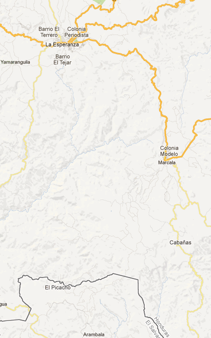
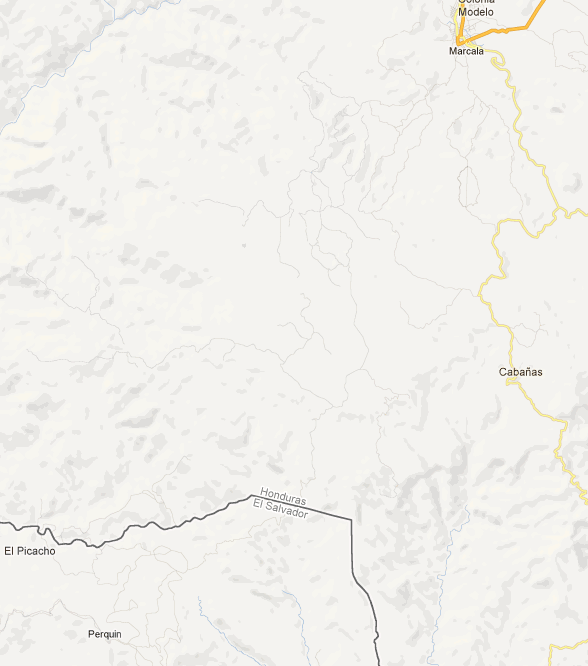
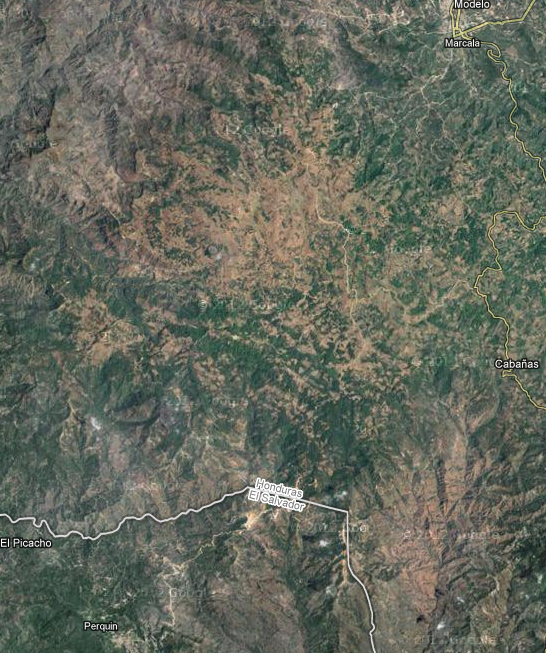
To illustrate this point, here are a few screen shots from Google Maps. Click on a shot to enlarge it. In the first one, the road from La Esperanza to Marcala is clear, but the town of Perquín is absent. As we zoom in, Perquín appears, but the road to it from Marcala (one that crosses an international border) does not. If we switch to satellite mode, we can just make out that road. So we can see it from space, but not in Google Maps’ database. Sigh.
The first leg, to La Esperanza passed without much fanfare. The country remained beautiful, the road reasonable. South of town, the road got more interesting. It quickly left the pavement and became dirt. The terrain was mountainous, the ground rocky and the climate alternating between dry and torrential. These elements combined to create a road surface criss-crossed by ruts, gullies and ravines. Most of it was rather hard-packed, so there was little danger of getting stuck, but progress was very slow. In many places, it was necessary to stop and survey the road ahead, plotting a course over and around the various obstacles. I figure our average speed on this stretch was under ten miles per hour.
And the van’s bouncing and pitching suggested another possible hazard. A couple days earlier, I had noticed a bubble on the side of our left rear tire. Possibly the result of hitting a huge pot-hole, unseen in the dim evening drizzle, as we searched for a hotel we had seen earlier. The jolt had nearly loosened our fillings, and may have damaged the tire as well. We’d not had an opportunity to replace it, and now the image of that blistered tire bouncing merrily along the rocky path was looming large in my mind.
Then, just to make things more interesting, the van began to stall again. Since we had made it through such behavior successfully once before, it was unsettling but not quite so worrisome, and I was able to pay attention and gather more information about the problem. My current hypothesis is that the intake to the fuel pump has somehow come loose, and is no longer at the bottom of the gas tank where it belongs. Maybe the rough road contributed to this. Anyway, although the gas gauge registered three-quarters full (and later filling it proved that this was at least close), the engine behaved as if it were running out of gas. Repeatedly. Our minds began to entertain images of pulling off the side of this mountain track, and pitching camp until we could flag down a passer-by to take one of us into Marcala for more gas.
Fortunately, by this time, Marcala was not too far distant. More over, the last ten kilometers or so were all on nicely paved highway. Amazing. Both the tire and the gas supply held, and brought us to our day’s destination.
It should also be noted that the paper map showed these paved 10K as part of a paved highway connecting La Esperanza and Marcala, separate from the mountain track we had just traveled. Perhaps such a road is planned, but only its southern quarter exists so far.
to be continued…

Pingback: And Into Perquín | Wandering Homestead