As has been mentioned here once or twice before, Joe likes to jump into water, whether from high places or whilst sporting SCUBA gear. Elizabeth seems most in her element in the dozens of museums we’ve visited, or winding through village marketplaces. My preferences run closer to E’s than J’s, but what I’ve enjoyed most of all this trip has been hiking through the mountains, forests, jungles and deserts. Yesterday was likely the best one so far.
The previous night we spent at Lago de Coatepeque, a caldera lake formed by two adjoining volcanos. It’s a beautiful lake, but it’s almost entirely surrounded by private homes, all with high-walled perimeters. From the road down at the level of the water and houses, it’s difficult to get a glimpse of the lake. There are some restaurants and a couple hotels interspersed among the houses, and the view from these is quite lovely. Likewise the view from the road farther up the caldera’s interior. There are many lookout points with spectacular views.

About five kilometers from the lake as the crow flies, are three more volcanoes, contained within the Cerro Verde Parque Nacional. Since Rocinante is Earth-bound, and because the roads in these parts are, to be kind, interesting, and also because there is much to look at in between, it took us a couple of hours to drive there.
The oldest, lowest and greenest of the three is Cerro Verde. It’s covered with trees: more jungle-y toward the base and more pine-y toward the top. If you squint, you can almost see it as part of the Smokies. The next tallest, and the newest, is Izalco. It started as a hole in the ground about 250 years ago, and has been growing ever since. It’s a dark, stark cone of volcanic rock and ash, and has erupted as recently as 2005. Rounding out the trio is Santa Ana, by far the tallest, with dense vegetation at the base, fading out gradually toward a barren peak.

At the park office on the side of Cerro Verde, one can arrange one of several available guided hikes. The easy one, to the peak of Cerro Verde, takes about 45 minutes. The grueling one, to the peak of Izalco, takes longer, but as we’d already done something very much like that, we all three decided to pass. The hike to the peak of Santa Ana and back takes about four hours, and looked promising. We decided to give it a shot.
All the hikes are guided, and accompanied by a couple of police officers (for safety, one supposes), one in front of the group and one in back. Our group consisted of the three of us, a dad and his two middle-school-age sons, and a couple of young women whose acquaintance we never quite made. The eleven of us set out at a reasonable pace through the forest/jungle, mostly shielded from the sun and quite comfortable. We saw much interesting vegetation, home to many butterflies and birds. As our altitude increased, the vegetation grew sparser, and the sun became very bright. And warm. And drying. The terrain reminded me somewhat of the Sonoran desert, in southern Arizona and Mexico.
Occasionally we’d encounter other groups, earlier risers than we, making the return trip. They assured us that we were almost there, and that achieving the peak was worth the effort. As we grew more tired, hot and dehydrated, I became skeptical. E and J stopped more often to rest and pull on their water bottles. At one point, I even found myself getting dizzy. We pressed on.
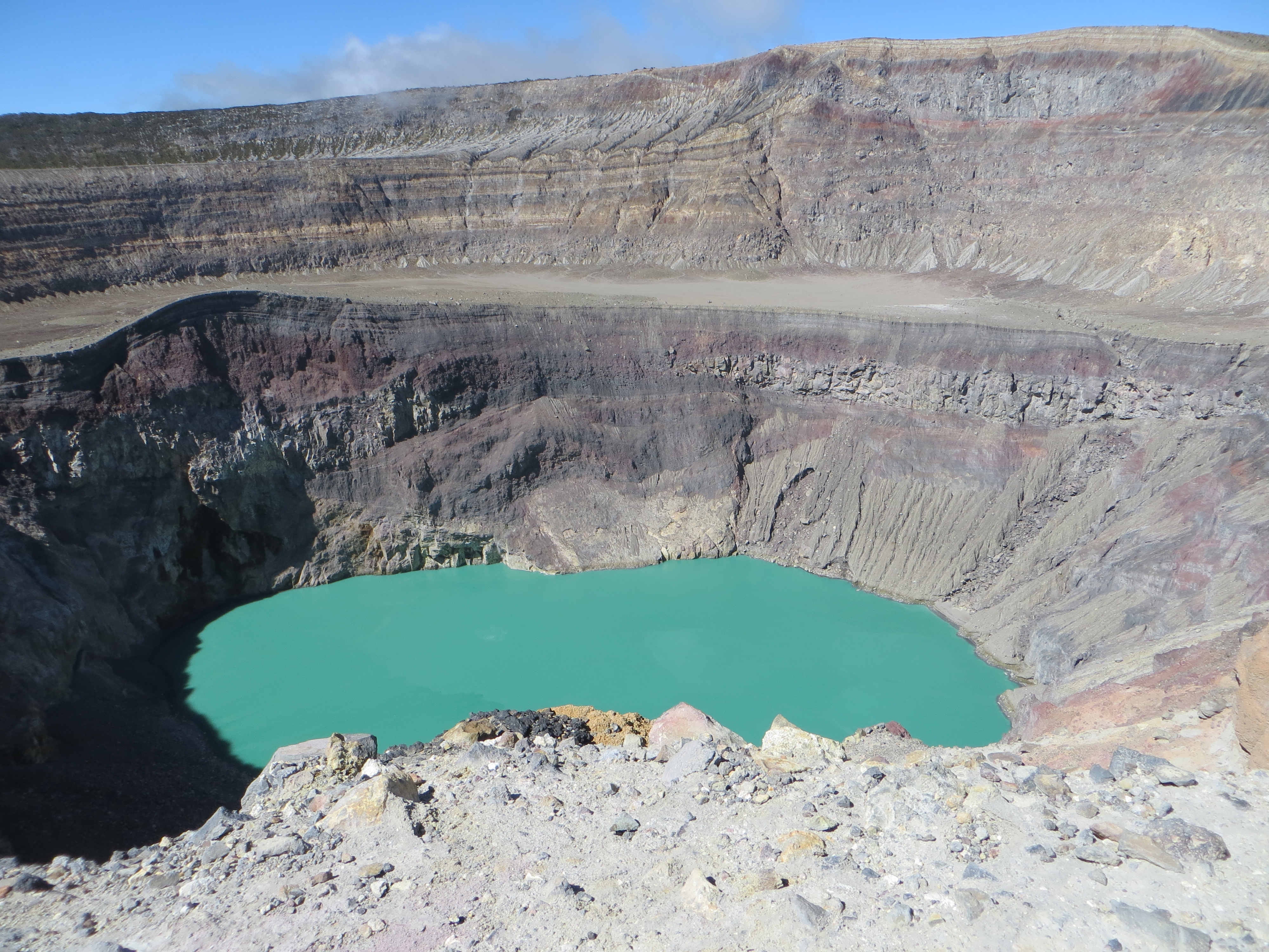
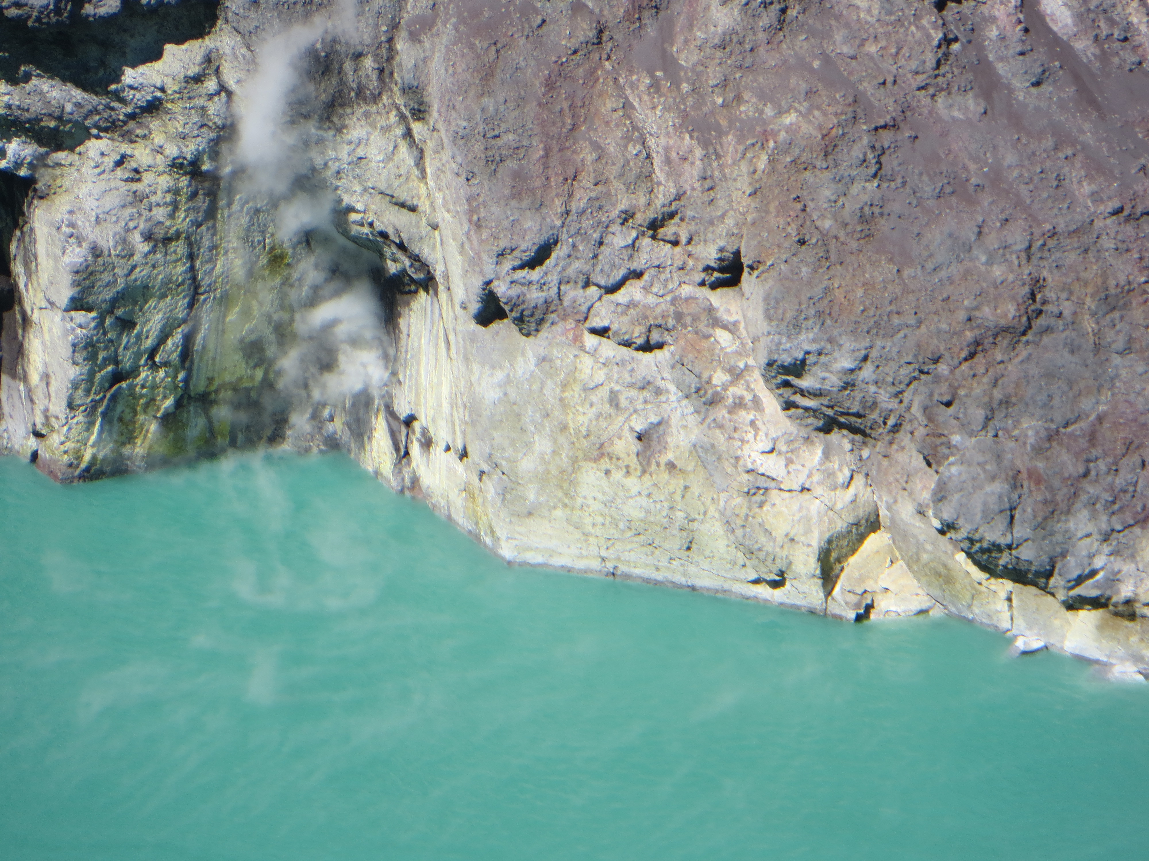
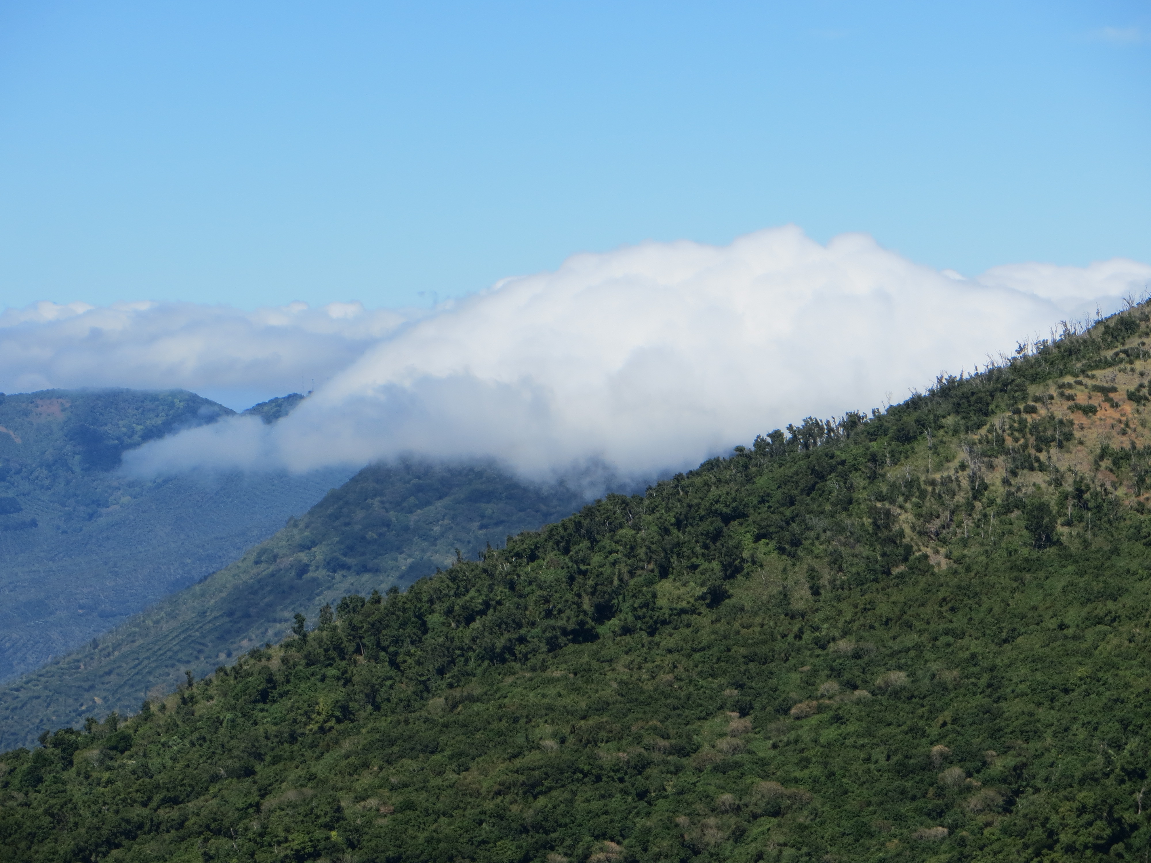
Then we reached the top, or close enough to it to see what it’s all about. Completely hidden from below, the peak of Santa Ana is, surprise surprise, a volcanic crater. It drops for maybe a couple hundred feet of beautifully stratified rock, past which it’s filled with cloudy, pale green water. Wisps of smoke and steam are visible in the water, and rising up from its surface. It takes a minute to realize that this is a clear indication that the volcano is still active. Standing and watching the water, rock and vapor, one also notices the clouds slipping between the mountain peaks and dissipating in the valley below. And oh yes, to the south you can see many miles of the El Salvador coastline and the Pacific beyond. The word spectacular does not come close.

At the beginning of the upward trek, the two boys hiking with their father decided to try out their English on us. We exchanged pleasantries in both languages and got to know a little bit about each other. Kenneth is fourteen and David is eleven. They live and go to school in San Salvador, where their Dad, Nelson, is a doctor, and their mom writes software. [Somebody else we met recently told us that Anglo names are very popular in El Salvador these days. Go figure.] As the hike grew more strenuous, the conversation dwindled. But at the top we all relaxed, shared food and talked some more, and then much more on the way down, when it was easier to catch one’s breath. Nelson’s English is about on a par my my Spanish (not so great), and we switched back and forth between them. Kenneth is very smart, nearly fluent in English, studies history, and had many questions on a wide range of topics. E shifted easily into teacher mode. All three of our companions were warm and friendly, and their company added another layer of enjoyment to the day.
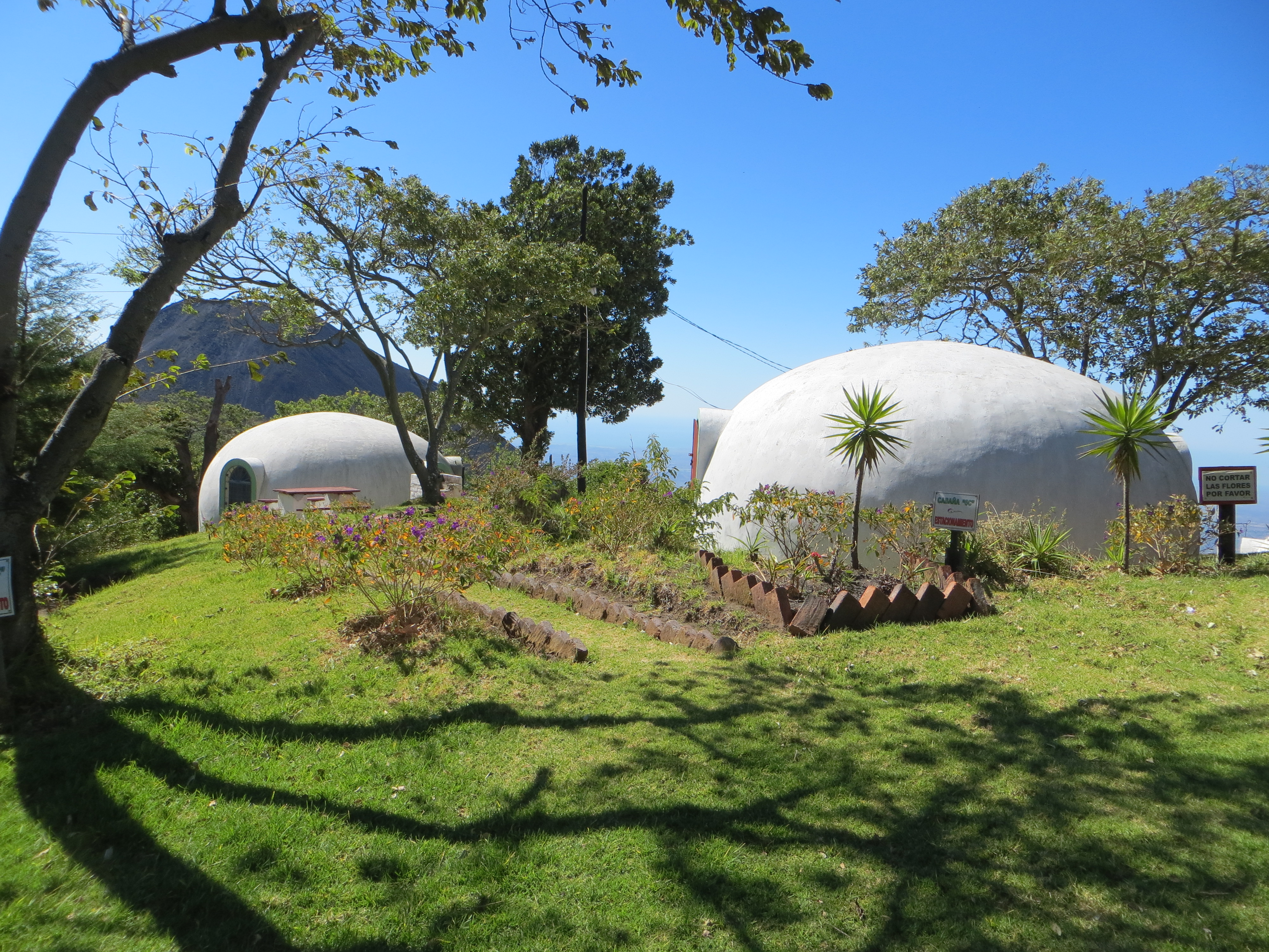
Back at the park offices on Cerro Verde, we discussed where we would spend the night. The park had a few cabins for rent, but these were small, grim, and not inexpensive. Down the road there were two other places with cabañas. One of the officials at the park said he liked Campo Bello better than the other place, so we decided to give it a try.
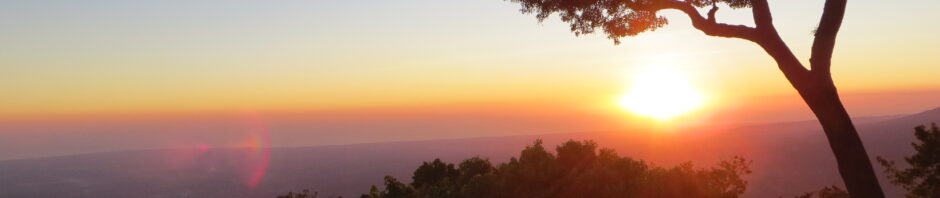
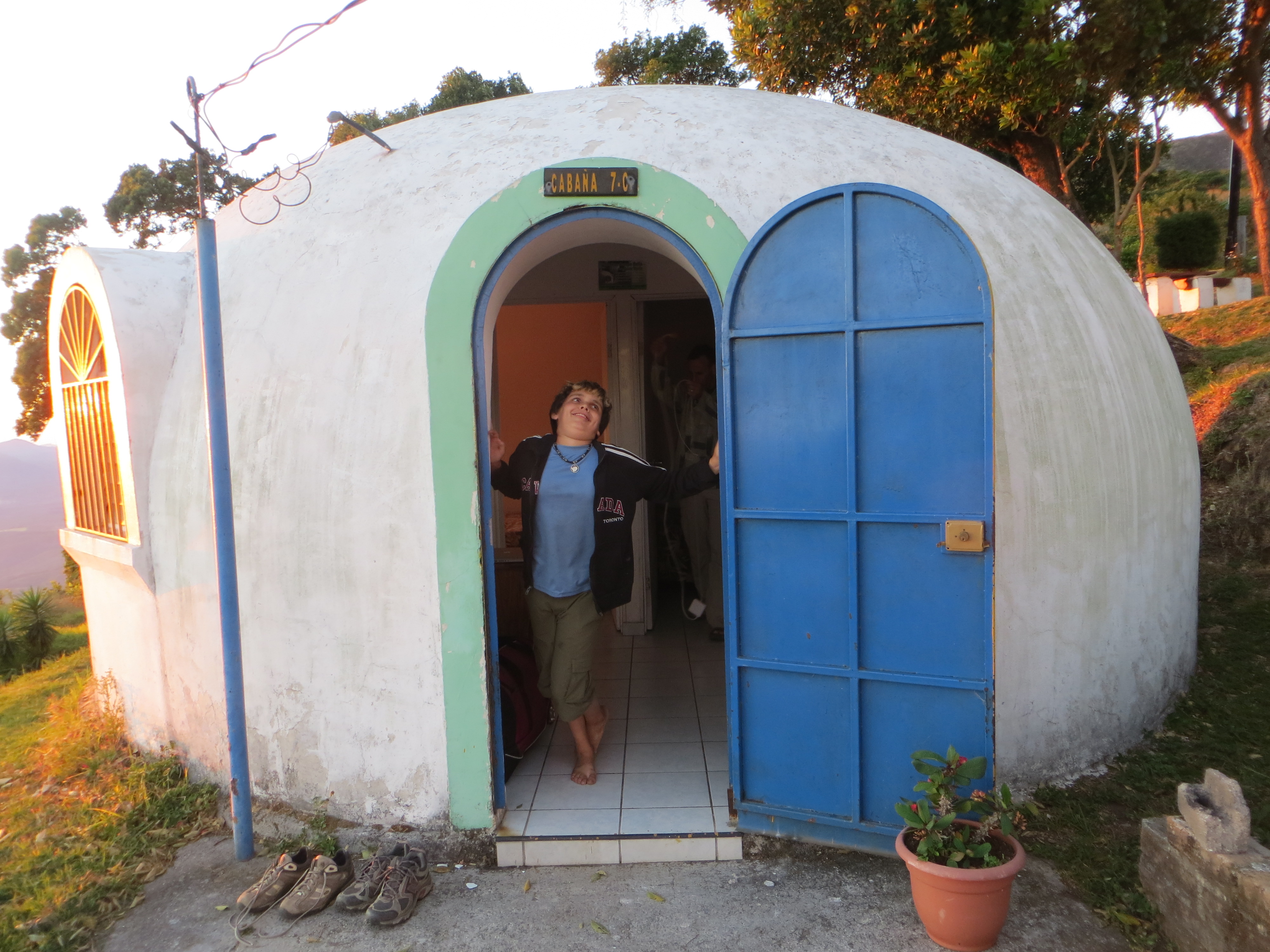
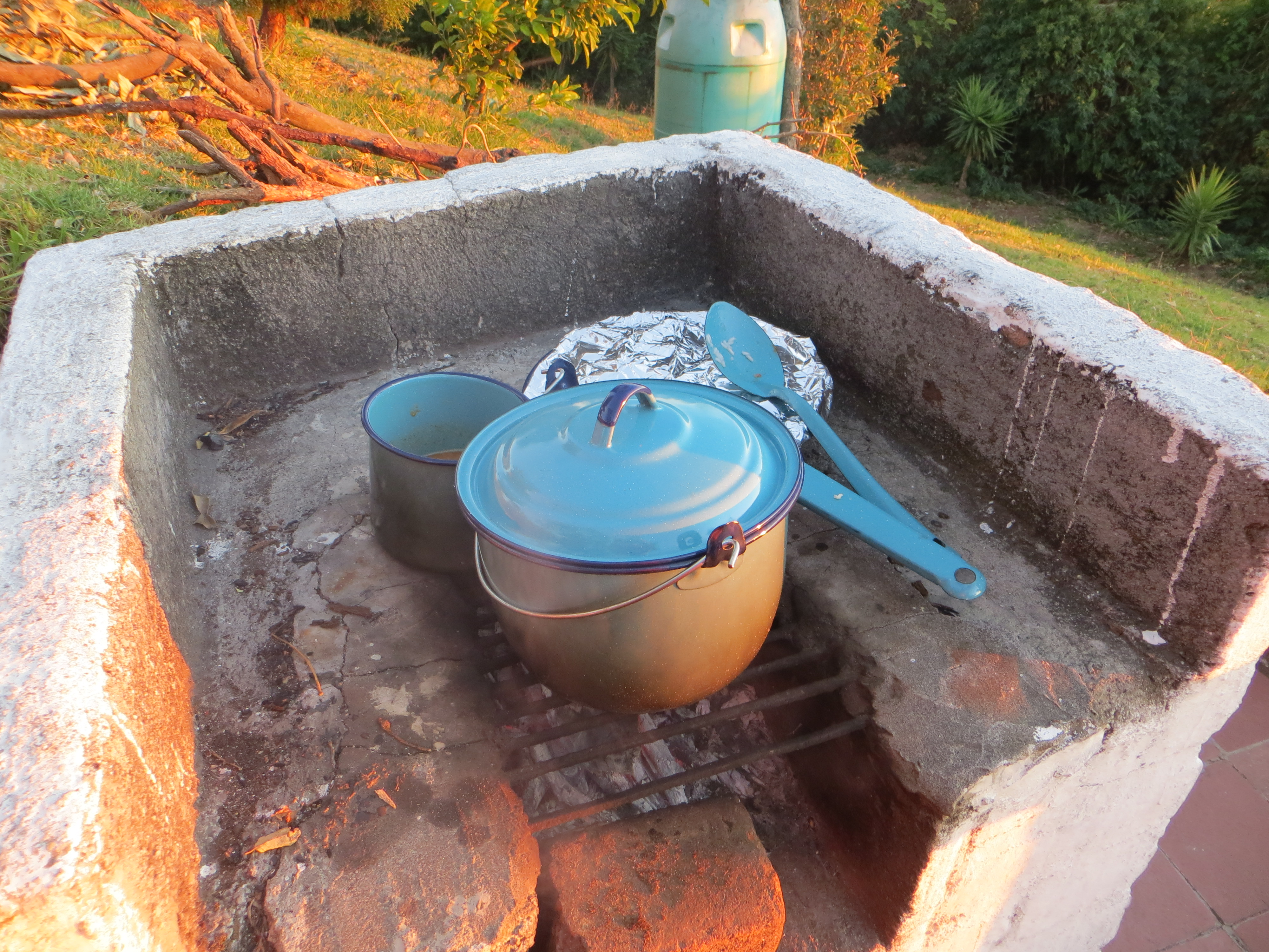
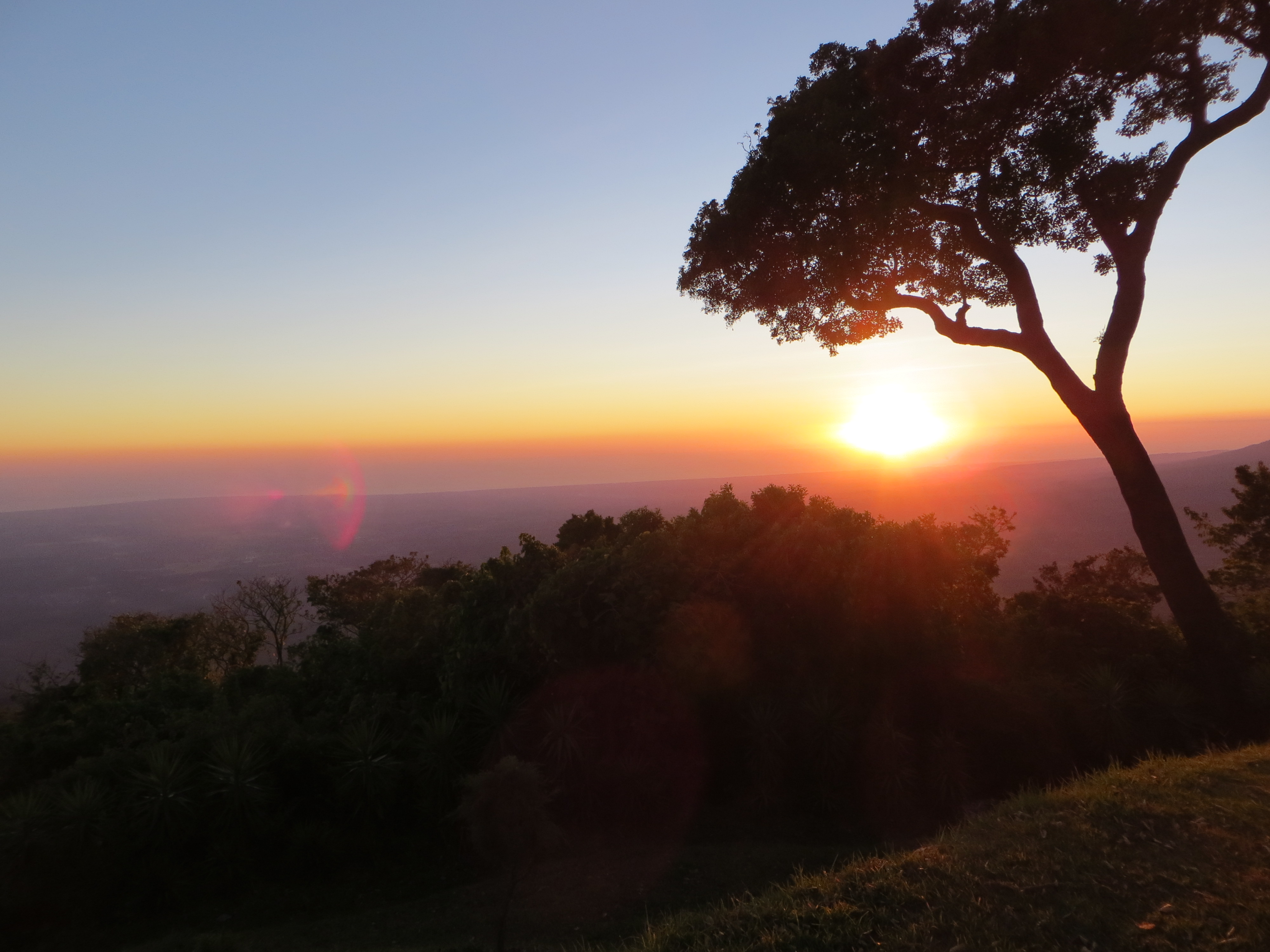
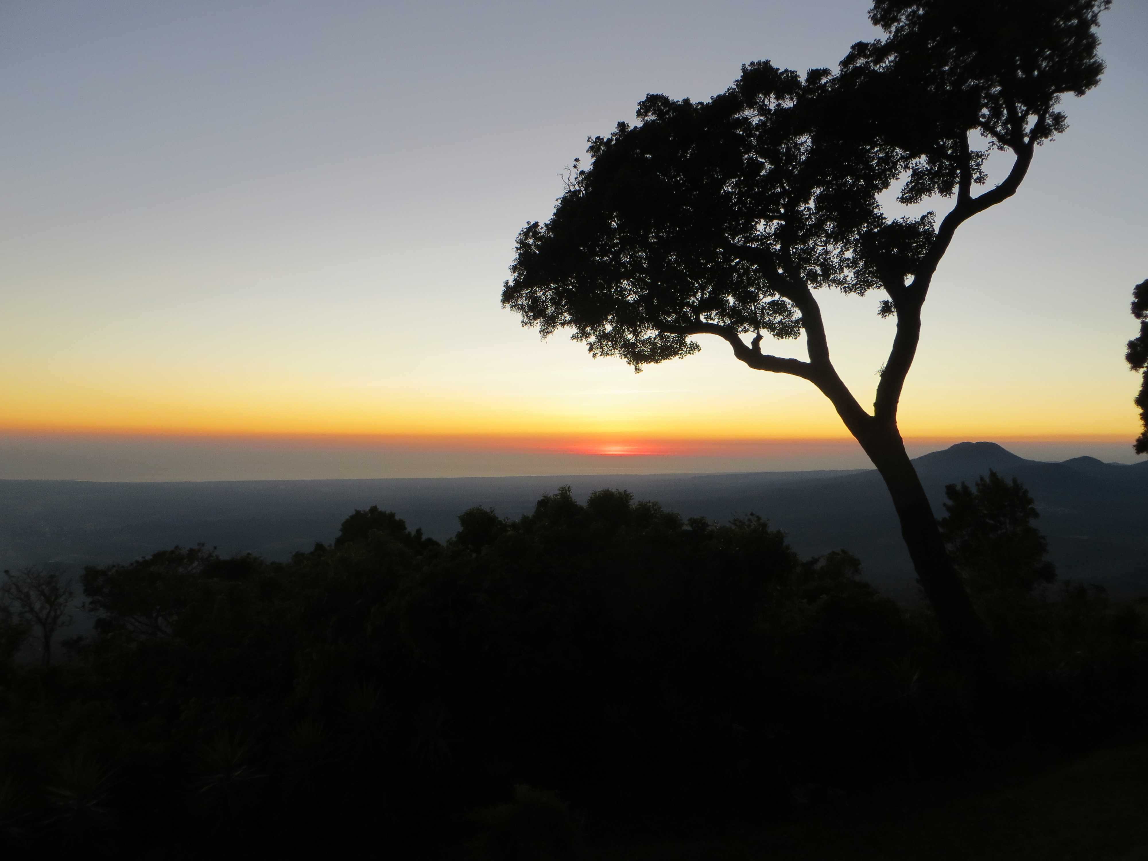
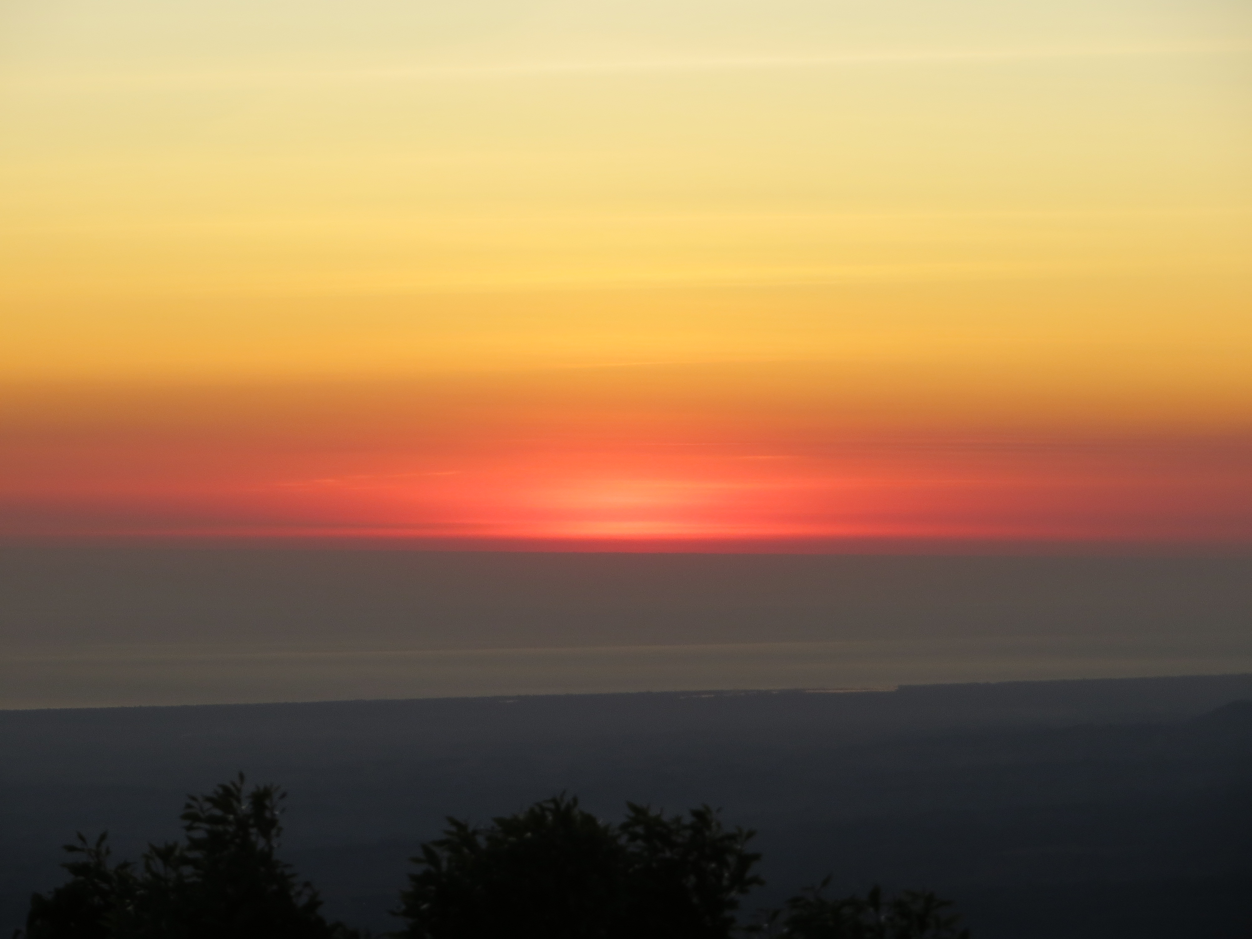
It turned out to be also not cheap, but worth every penny in view and charm. The cabins are like ferro-cement igloos, very clean, and overlooking yet another amazing view. This one was from high on the side of Cerro Verde, looking south over the valley toward the sea. Turning around, we could see behind us Santa Ana, the peak we had just climbed. We gathered wood and made dinner on the stone grill just outside the front door, and watched the sun sink into the Pacific. The lights came on in the various cities and villages around the valley, some of which we had visited, others we’d seen only on the map. The stars came out, the sky turned black, the wind continued to blow, and we retired to the igloo to watch Brave on my laptop.

 In the morning, we rose early (for us), cooked breakfast, and headed back down the road toward Armenia and San Salvador.

Wow. That’s about all I can say. I think I’d be between your choices and E’s. I love water but not the jumping in it part so much, especially not from high places. The photos are stunning. What a wonderful, wonderful hike. Thanks so much to both of you for sharing so eloquently much of what you’ve been experiencing.
This read reminds me of many days before, between western U.S., the
native reservations in Arizona, the Grand Canyon, and so many wondrous places I have had the privilege of visiting. Wonderful!